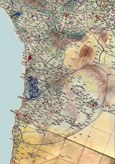
This map covers the majority of the empire of Sekuate, divided into northern and southern states. The angle is a bit skewed for purposes of fitting it onto the paper upon which it was drawn and later scanned, so the direction of true north is slanted to the right (following the grid lines). Near the top left corner is the city of Selaue. Down along the coast is the large metropolis of Seas. South of Seas are the two small nations of Forivor and Ere (with the marshes). The large political unit south of the marshes is the southern part of Sekuate, wherein lies Lyas. South of this region is Aivana, the site of much action in the second volume of the Dream Land series.
You can click on the map to enlarge it for closer viewing.


No comments:
Post a Comment